


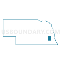
10G-7 Precinct, Lancaster County, Nebraska
About
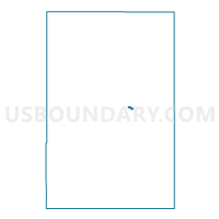
Outline

Summary
| Unique Area Identifier | 613550 |
| Name | 10G-7 Precinct |
| County | Lancaster County |
| State | Nebraska |
| Area (square miles) | 0.19 |
| Land Area (square miles) | 0.19 |
| Water Area (square miles) | 0.00 |
| % of Land Area | 100.00 |
| % of Water Area | 0.00 |
| Latitude of the Internal Point | 40.79099800 |
| Longtitude of the Internal Point | -96.61664180 |
Maps

Graphs
Select a template below for downloading or customizing gragh for 10G-7 Precinct, Lancaster County, Nebraska


Neighbors
Neighoring Voting District (by Name) Neighboring Voting District on the Map
- 10F-10 Precinct, Lancaster County, NE
- 10F-3 Precinct, Lancaster County, NE
- 10F-5 Precinct, Lancaster County, NE
- 10F-6 Precinct, Lancaster County, NE
- 10G-1 Precinct, Lancaster County, NE
- 10G-5 Precinct, Lancaster County, NE